why space matters
Infrastructure
In 2020, over 2,500 infrastructure projects were announced across the world--a 5.5% increase over 2019, highlighting a new global priority coming out of the COVID-19 pandemic. Crumbling civil infrastructure across the world is a direct result of climate change, natural disaster, and poor human design and repair.
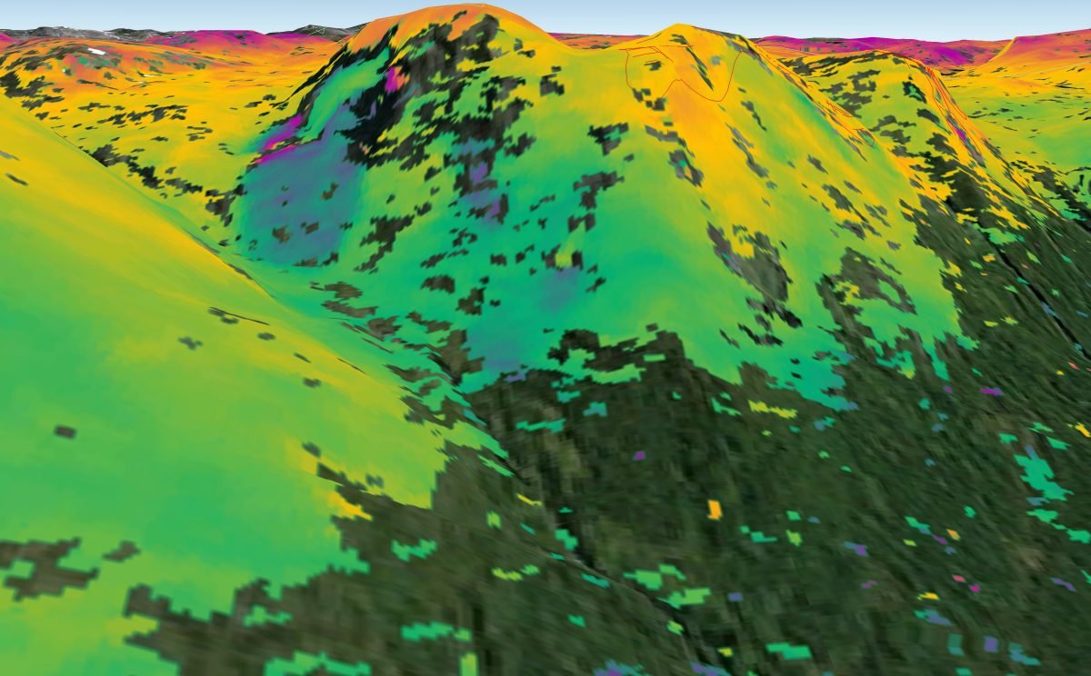
A large-scale solution to monitoring the state of Earth’s infrastructure is satellite-based monitoring. Satellite-based synthetic aperture radar interferometry, known as InSAR, has continuous, all-weather monitoring capabilities and the power to oversee mass movements on Earth’s surface, allowing urban city planners to mount timely responses to critical infrastructure needs. Bird.i is a satellite service that curates the world’s latest satellite imagery for project planning, construction monitoring, and land maintenance. Highlighting the unique power of scale when it comes to infrastructure, Bird.i makes imagery more accessible for viewing a site’s location, land use, scale and proximity to key access points.
Satellite technology allows governments and corporations to make better-informed decisions regarding the buildings, bridges, and roads that house and support civilization. Space matters.
References: